
Archive for March 2026
Mapping Minerals from Space: How Hyperspectral Satellites Are Changing Exploration
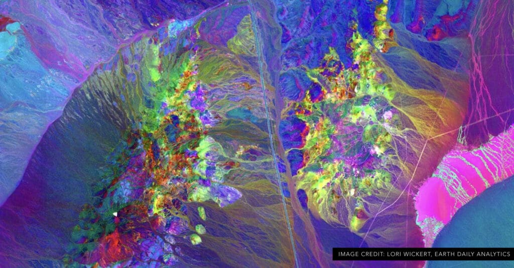
Exploration teams have used satellite imagery for decades to understand regional geology, map alteration systems, and prioritize targets. Until recently, however, satellite remote sensing was limited in its ability to identify specific minerals at the surface. A new generation of hyperspectral satellites is changing that. These systems measure reflected light in hundreds of narrow wavelength…
Read More